Rifugio Allavena - Monte Grai - Pietravecchia - Rifugio Allavena


elevation profile
Distance: 10,5 km
Time: 5 - 7 hours Hike details
increase: 624 m
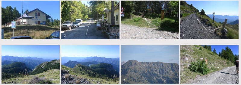
The starting point of the walk is the Rifugio Allavena (Fig. 1)
Walk a few hundred metres in the direction of the arrow (Fig. 2) until, on a left-hand bend, you come to the junction with the footpath leading to Monte Grai (Fig. 3). Follow the path uphill; it is steep in places and paved with stones. After about 1 km, the path winds its way up the meadow slopes. After about 1.65 km, you’ll come to the old military road leading uphill from Rifugio Allavena (Fig. 4).
Here you can decide whether to turn left onto the old military road (Route 1, blue, or Route 2, yellow) or continue to the right, past the Rifugio Monte Grai, a former barracks dating from the Franco-Italian War. Along the way, you’ll enjoy beautiful views (Figs. 5, 6, 7). After about 1 km, you’ll reach a junction; follow the path to the left (Fig. 8).
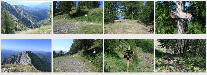
Follow the path which takes you round the summit of Monte Grai and, after about 1.5 km through woodland and across meadows, leads to a fork in the path (Fig. 10). Here you can decide whether to head back to Rifugio Allavena (Route 3, green) or carry on to the summit of Pietravecchia (red). Along the way, you’ll have a lovely view of the military road winding its way uphill in numerous hairpin bends (Fig. 9). At the fork, keep to the right (Fig. 10) and after about 100 m, turn left towards the summit of Pietravecchia (2038 m) (Figs. 11, 12). Follow the narrow, mostly grass-covered path uphill through the forest. After about 1.2 km, you will reach the summit. There you can see some fortifications from the Italo-French War that are still partially preserved. From here, you have a lovely view of the neighbouring Toraggio (1,971 m) (Fig. 13). To descend, follow the same route back until, after about 1.25 km, you reach the junction that led you uphill to Pietravecchia (Fig. 14). Continue straight on until, after a few metres, you come to a path leading downhill, which is narrow and, in places, steep as it winds through the woods. After about 600 m, you will reach a signpost (Fig. 15). Here you can decide whether to continue straight on for a few metres and return to the Rifugio Allavena via the military road (Option 1, blue), or turn right and follow the steep, narrow path downhill (Fig. 16).
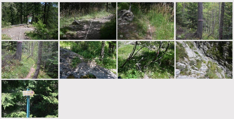
After about 670 m, you will come to a fork in the path (Fig. 17). To the left, a narrow path runs along the slope – with rope handrails in places – to the military road. To the right, the path leads downhill. After about 500 m, a path branches off to the left (Fig. 18). Follow the path, which winds its way downhill (Figs. 19, 20, 21) and eventually leads to a rocky plateau, parts of which are filled with water (Fig. 22). Cross this plateau and climb up the opposite side of the slope (Fig. 23), following the path. After a short distance, you will reach a rocky section secured with steel cables (Fig. 24). Carefully climb down along the steel cables until you reach the bottom of the stream bed, and then follow the path which runs along the slope – secured in places by steel cables – until, after about 1 km, you leave the ‘sentiero innamorati’ and rejoin the military road (Fig. 25).
Now follow the road for the last few metres to Rifugio Allavena.