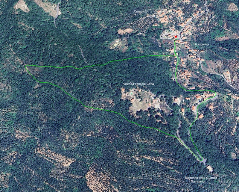
Circular route Pantasina 2
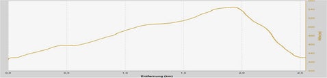
Elevation profile
Distance: 2.55 km
Time: 3/4 - 1 ½ hours
Ascent: 120 m
Data on the hike
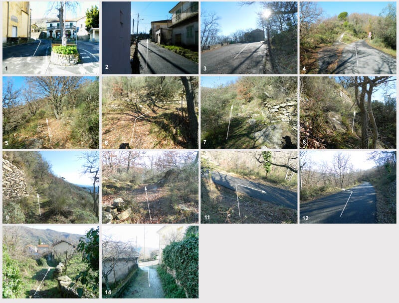
The starting point of the hike is the church square in Pantasina.
Take Via Santuario (arrow in Fig. 1) past the Azienda Agricola Pino and continue uphill (Fig. 2) until you reach the church of Madonna del la Guardia (Santuario) a few hundred metres after the last houses (Fig. 3). From there and along the way you have wonderful views of Pantasina, Prelà Castello, Dolcedo, Porto Maurizio, Valloria, Tavole and Villatalla. Follow the road in a sharp right-hand bend and after approx. 100 m turn left onto a concrete path (Fig. 4), which leads uphill and soon turns into a dirt track (Fig. 5). Follow this path until it ends in a sharp right-hand bend after a short ascent. At this bend (fig. 6), turn left onto a narrow path and follow this path uphill (fig. 7) until you reach a mule track (fig. 8). Turn right and follow this path (fig. 9), which leads from Villatalla to Pantasina and is marked in red. After a short climb of a few hundred metres, you will reach a crossroads (fig. 10). Continue straight ahead. After a short, winding downhill stretch, you reach the provincial road (fig. 11 ), turn right and after a few metres turn left (fig. 12). Follow this mule track downhill until you reach the provincial road again (Fig. 13). Turn left (fig. 14, after approx. 150 metres you will reach the church square in Pantasina.